Avondale, one neighborhood at a time
From Old Town's Western Avenue to the lakes of Crystal Gardens and the new streets of Alamar, a tour of how Avondale's neighborhoods fit together.
Avondale doesn't divide itself into formal villages the way some Valley cities do. Instead it grew outward from one main street, district by district, as farm fields became subdivisions and the freeway pulled new development north. The result is a city where a historic storefront and a brand-new lakeside apartment block can be a short drive apart. Here is a tour, from the oldest streets to the newest.
How the city maps itself
The clearest guide to your own corner of Avondale is the city's My Avondale Services map. Type in an address and it shows the trash and recycling schedule, the code compliance contact, police resources and the homeowners association for that property. The city's geospatial team also publishes a printable neighborhoods map alongside its general plan and trails maps.
For planning and business, the city talks in districts: Old Town on Western Avenue, The BLVD at Interstate 10, and the West Valley Health Quarter on McDowell Road. Older neighborhoods keep names that come up in city programs. When Avondale Fire and Medical volunteers went door to door handing out smoke alarms over the past two and a half years, they walked Old Town, Las Ligas, Cashion and Rio Vista.
Old Town, the historic heart
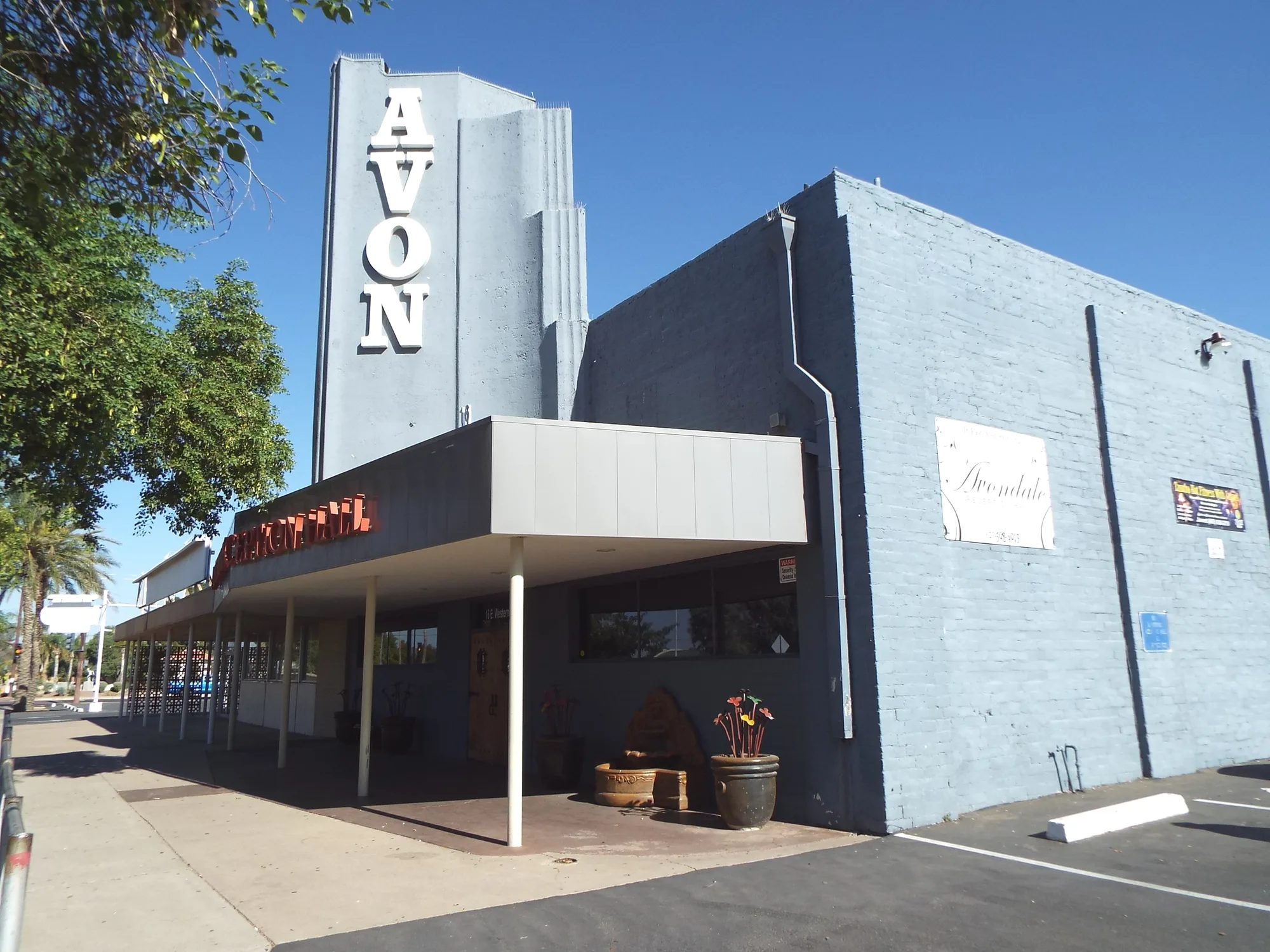
Old Town is where Avondale began. Billy Moore's 1880 stage stop at Coldwater grew into a small business district, and growth followed Western Avenue, still the center of Old Town today. The city calls this area Historic Avondale, and its character comes from ranching, the railroad and cotton farming. It also served travelers: Dessie Lorenz Park, on Main Street a couple of blocks south of Western, was first built as a rest area for U.S. 80, the highway that once ran through town.
Today the stretch from Central Avenue to Dysart Road mixes family businesses, murals and small plazas. A.B. Sernas Plaza, beside the Sam Garcia Western Avenue Library, honors a former councilmember and his wife Francisca, who both picked cotton for the Goodyear Farms Cotton Company. Doc Rhodes Plaza, with its gazebo, was once a gas station. This year the city rebuilt the intersection of Western and Central avenues and began a new Old Town Plaza at Dysart Road, where a time capsule will wait for the city's 100th birthday in 2046. For dinner, The Pasta Factory on East Western Avenue is a family Italian restaurant run by a father and his four daughters, serving pasta, seafood and steaks.
Las Ligas, Cashion and Rio Vista
Just outside Old Town are some of the city's longest-settled neighborhoods. Las Ligas takes its name from its farm past: residents chose it because laborers used rubber bands, ligas, while harvesting the nearby fields, and Las Ligas Park keeps the name. South Avondale is home to the Cashion communities, served by the Littleton Elementary School District and by a police substation on West Pima Street. Cashion has deep community roots. Mercy House, which has supported Southwest Valley families with food, clothing and education since 1994, was founded by longtime Cashion resident Mercy Arredondo, and it won the city's Community Impact award for nonprofits in 2024.
Coldwater Springs and the river
Along the east levee of the Agua Fria River, the Coldwater Springs neighborhood keeps the city's original name alive. The paved Agua Fria path skirts the community as it runs from beneath Interstate 10 south under Van Buren Street, and a pedestrian HAWK signal at Coldwater Springs and 118th Avenue helps walkers cross. Future phases of the path are planned to reach Tres Rios and the Gila River.
The BLVD and the Gateway
The city's newest gathering place is The BLVD, just south of the freeway at Avondale Boulevard. The city describes it as six districts with more than 2,000 apartments, hotels, the Randall McDaniel sports complex and a one-acre lake at Park Avenue Plaza, complete with koi pond, bridges and a splash pad. Paris Banh Mi Cafe Bakery opened here recently and serves bánh mì on French baguettes, pho, vermicelli bowls and boba teas.
Around it, the Gateway area along McDowell Road holds the Avondale auto mall, Universal Technical Institute and the West Valley Health Quarter, which stretches from 99th Avenue to Dysart Road. Friendship Park, more than 60 acres, gives this busy corridor its green space.
Wetlands and Dysart Road
In Crystal Gardens, the city's trail system winds through a 72-acre wetland, with 8.75 miles of paths circling 14 lakes. Farther north, along Dysart Road, Indian School Road and Rancho Santa Fe Boulevard, the neighborhoods are newer and suburban. The Algodon Arch on Santa Fe Trail, a public artwork whose name means cotton in Spanish, nods to the fields that were here first, and the Goodyear Farms Historic Cemetery sits nearby. Estrella Mountain Community College anchors Dysart Road. Zeta's Grill on North Dysart Road serves Lebanese cooking, including shawarma, kabobs and manakish, and Colados Coffee & Crepes, a family business on Indian School Road started in 2014, makes sweet and savory crepes.
The new south
South of the freeway, between Avondale Boulevard and Dysart Road, the city keeps growing. Alamar, less than four miles south of Interstate 10, has a 40-acre park that has a fishing pond, an amphitheater, a splash pad and dog parks. Across the city, newer communities such as Three Rivers Ranch, Entrada, Shadow Ridge and Verde Trails have also welcomed families, and Donatela Park, a new neighborhood park, is under construction.
Wherever you land, check the city map for your homeowners association, then go meet the neighbors. Each part of Avondale tells a different chapter of how Coldwater became a city.
Sources and further reading 27
- City of Avondale Geospatial Services: avondaleaz.gov/government/departments/information-technology/maps-2/checked November 7, 2026 · My Avondale Services address lookup shows trash and recycling schedules, code compliance contacts, HOA information and police resources; printable maps include Neighborhoods, General Plan and Avondale Trails.
- City of Avondale Economic Development: avondaleaz.gov/government/departments/economic-development/ed-life-in-avondale/checked November 7, 2026 · West Valley Health Quarter on McDowell Road from 99th Avenue to Dysart Road; Littleton Elementary School District serves the Cashion communities of south Avondale.
- City of Avondale: avondaleaz.gov/news/2026/09/fire-prevention-week-in-avondale/Published September 29, 2026 · checked November 7, 2026 · Smoke alarm walks over two and a half years in Old Town Avondale, Las Ligas, Cashion and Rio Vista neighborhoods.
- City of Avondale: avondaleaz.gov/news/2026/05/avondale-celebrates-80-years/Published May 6, 2026 · checked November 7, 2026 · Billy Moore's 1880 Coldwater settlement and stage stop; growth along Western Avenue, still the heart of Old Town; character shaped by ranching, railroads and cotton farming.
- City of Avondale: avondaleaz.gov/news/2026/08/construction-begins-on-old-town-plaza-improvements-in-avondale/Published August 12, 2026 · checked November 7, 2026 · Old Town Plaza in Historic Avondale at the southwest corner of Dysart Road and Western Avenue; time capsule to open in 2046.
- City of Avondale Parks, Recreation and Libraries: avondaleaz.gov/government/departments/prld/parks/neighborhood-parks-and-plazas/checked November 7, 2026 · Dessie Lorenz Park built as a U.S. 80 rest area; A.B. Sernas Plaza by Sam Garcia Library honoring A.B. and Francisca Sernas, Goodyear Farms Cotton Company field laborers; Doc Rhodes Plaza gazebo on a former gas station; Las Ligas name from rubber bands used by farm laborers; Park Avenue Plaza lake, koi pond, bridges and splash pad.
- City of Avondale: avondaleaz.gov/locations/dessie-lorenz-park/checked November 7, 2026 · Dessie Lorenz Park at 202 E. Main Street, south of Western Avenue.
- Discover Avondale (City of Avondale destination marketing): discoveravondale.com/explore/old-town-avondale/checked November 7, 2026 · Old Town's Western Avenue from Central Avenue to Dysart Road with locally owned businesses, murals and festivals.
- City of Avondale: avondaleaz.gov/news/2026/07/western-avenue-and-central-avenue-intersection-to-close-for-reconstruction/Published July 8, 2026 · checked November 7, 2026 · Western and Central avenues intersection reconstructed in July 2026.
- The Pasta Factory: thepastafactoryaz.netchecked November 7, 2026 · Family-owned Italian restaurant at 701 E Western Ave run by a father and his four daughters; pasta, seafood, steaks.
- Avondale Police Department: avondaleaz.gov/government/departments/police/faq/checked November 7, 2026 · Cashion Sub-Station at 10857 W. Pima St.
- City of Avondale Economic Development: avondaleaz.gov/government/departments/economic-development/ace-awards/checked November 7, 2026 · Mercy House, serving Southwest Valley youth and families since 1994, founded by long-standing Cashion resident Mercy Arredondo with Cornerstone Christian Center; 2024 Community Impact Award for Nonprofit.
- City of Avondale Parks, Recreation and Libraries: avondaleaz.gov/government/departments/prld/parks/trails-multi-use-paths/checked November 7, 2026 · Agua Fria path on the east levee from beneath I-10 south under Van Buren, skirting the Coldwater Springs community; future phases to Tres Rios and the Gila River; Crystal Gardens 72-acre wetland, 8.75 miles, 14 lakes.
- City of Avondale: avondaleaz.gov/news/2026/07/hawk-crossings-help-keep-avondale-moving-safely/Published July 28, 2026 · checked November 7, 2026 · HAWK crossing at Coldwater Springs and 118th Avenue.
- City of Avondale Economic Development: avondaleaz.gov/government/departments/economic-development/the-blvd/checked November 7, 2026 · The BLVD south of I-10 at Avondale Boulevard: six districts, 2,000+ multi-family units, hotels, a one-acre lake.
- Discover Avondale (City of Avondale destination marketing): discoveravondale.com/explore/the-blvd/checked November 7, 2026 · Randall McDaniel sports complex at The BLVD; Paris Banh Mi among BLVD dining (via Explore page).
- City of Avondale: avondaleaz.gov/news/2026/03/honored-past-bold-future-avondale-marks-80-years-at-2026-state-of-the-city/Published March 10, 2026 · checked November 7, 2026 · Paris Banh Mi among new destinations that opened at The BLVD; new communities Three Rivers Ranch, Entrada, Shadow Ridge, Alamar and Verde Trails.
- Paris Banh Mi Cafe Bakery - Avondale: parisbanhmiavondale.comchecked November 7, 2026 · At 645 N Avondale Blvd, Ste 101: bánh mì on French baguettes, pho, vermicelli bowls, boba teas and coffee.
- Avondale Fire & Medical: avondaleaz.gov/government/departments/fire-medical/firestations-facilities/checked November 7, 2026 · Station 172 serves the Gateway area including the Avondale Auto Mall and Universal Technical Institute; Station 171 serves the Historic District.
- City of Avondale Parks, Recreation and Libraries: avondaleaz.gov/government/departments/prld/parks/community-parks/checked November 7, 2026 · Friendship Park 60+ acres on McDowell Road; Alamar Park 40 acres with fishing pond, amphitheater, splash pad and dog parks.
- City of Avondale: avondaleaz.gov/government/public-art/art-walk/checked November 7, 2026 · Algodon Arch by Joe Tyler at 3500 N Santa Fe Trail; Memoria Entre Las Flores at 3720 N Santa Fe Trail (the cemetery address).
- City of Avondale Parks, Recreation and Libraries: avondaleaz.gov/government/departments/prld/parks/goodyear-farms-cemetery/checked November 7, 2026 · Goodyear Farms Historical Cemetery at 3720 N Santa Fe Trail.
- Zeta's Grill: zetagrill.comchecked November 7, 2026 · Lebanese restaurant at 2935 N Dysart Rd, Avondale: shawarma, kabobs, manakish.
- Colados Coffee & Crepes: colados.com/our-storychecked November 7, 2026 · Family business founded January 29, 2014; locations in Avondale, Goodyear and Phoenix; crepes and coffee.
- Discover Avondale (City of Avondale destination marketing): discoveravondale.com/about/community/checked November 7, 2026 · Colados Coffee & Crepes listed as a generational business, family owned since 2014.
- City of Avondale: avondaleaz.gov/government/public-meetings/alamar-lakin-cfd-board/checked November 7, 2026 · Alamar lies less than 4 miles south of I-10 between Avondale Boulevard and Dysart Road.
- City of Avondale: avondaleaz.gov/news/2026/07/avondale-celebrates-park-and-recreation-month/Published July 8, 2026 · checked November 7, 2026 · Groundbreaking on Donatela Neighborhood Park.