Parks, trails and outdoor places in Mesa
From Red Mountain Park's lake to the new Signal Butte pump tracks and the Hawes foothills: where Mesa walks, rides and fishes, and the city's rules for every season.
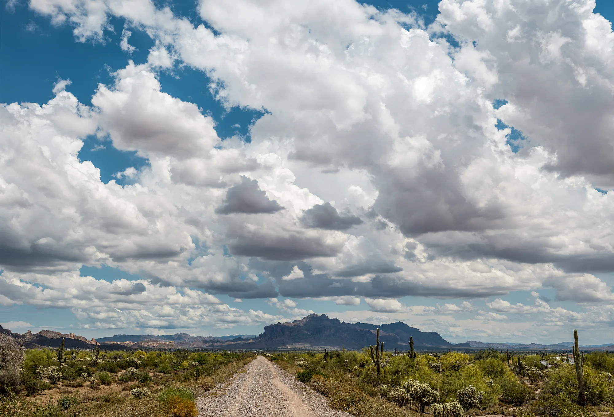
November is when Mesa gets back outside. The heat has broken, the splash pads have switched to winter hours, and the city's parks fill with weekend fishermen, disc golfers and families on bikes. Mesa's parks run from neighborhood lawns to desert loops at the foot of the mountains, and the city maintains its own trail list, so it is easy to match an outing to the time you have.
The big parks: Red Mountain, Riverview and Signal Butte
Red Mountain Park, on East Brown Road in northeast Mesa, is the city's giant at more than 1,100 acres. It has a fishing lake that is part of the city's Community Fishing Program, an unpaved walking path, disc golf, ball fields, pickleball and volleyball courts, and a shaded playground. It is a good choice when you want a long, easy walk with room to spread out a picnic.
Riverview Park, at 2100 W. Rio Salado Parkway, covers about 155 acres beside the Cubs' spring training home, Sloan Park. It has its own fishing lake, a shaded playground with a 50-foot climbing tower, and paved sidewalks looping through the grounds. Its biggest asset for walkers and cyclists is the Rio Salado Pathway, a shared-use path that links the park west to Tempe Town Lake. From November through February the splash pad runs on shorter winter hours.
The newest addition is in the southeast. Signal Butte Park's second phase, at 3355 S. Signal Butte Road, is a city project scheduled to finish in fall 2026. Phase II adds about 1.6 miles of asphalt and stabilized-soil paths, pump tracks for young riders, ramadas, a restroom and a pedestrian bridge over the wash that ties it to the original park.
Desert loops and mountain trails
For a desert walk without leaving the city, Mesa keeps a handful of short, marked trails. Red Mountain Nature Park, at 7921 E. McKellips Road, has three loops: the Arroyo Trail, the Barrel Trail and the Coyote Perimeter Trail, which at just under a mile is the longest. The Mountain Vista Trail, at 3932 N. Recker Road, is a 10-foot-wide, one-mile path with two lookout points, plus an accessible concrete loop around a botanical garden. Both are open sunrise to sunset.
Riders have options too. Desert Trails Park has two pump tracks and six bike trails, three of them open to hikers, and Desert Arroyo Park has a half-mile paved Discovery Loop and a three-quarter-mile explorers path for hiking and biking.
At the city's northeast edge, the Hawes trail system climbs into the foothills on Tonto National Forest land. A short stretch of the Hawes Loop is city-maintained, with access through the Las Sendas neighborhood, and the nonprofit Hawes Trail Alliance counts about 25 miles of approved trail in the wider system, shared by mountain bikers, hikers and runners. Next door, Maricopa County's Usery Mountain Regional Park covers more than 3,600 acres at the west end of the Goldfield Mountains. Its best-known path, the Wind Cave Trail, climbs to an alcove on Pass Mountain where seeping water feeds hanging gardens of rock daisy, and its nature center is open daily through the cool season.
Seasons and safety, by the city's own rules
Most Mesa parks are open from sunrise to 10 p.m. or as posted, and the nature trails close at sunset. Dogs are welcome on a leash no longer than six feet, and owners must clean up after them. Groups, classes and teams need a permit, and there is no camping. Check a park's page before you go for renovation closures; in fall 2026, for example, the city closed the playgrounds at Augusta Ranch Park and Carriage Lane Park for renovation into the winter.
The seasons change what makes sense. Usery's nature center opens daily from November through April, and the park itself moves to earlier, longer hours from May through October. In summer, plan walks for first light and carry more water than you think you need. Mesa's heat safety page lists year-round water refill stations, including at Pioneer Park downtown and the Red Mountain Library, along with cooling locations and how to get a ride to them. For summer storms, the city keeps a separate severe weather preparation page.
Maps and trail conditions
The city's Trails page has a map for each nature trail and the rules in full, and individual park pages list amenities and current closures. The Hawes Trail Alliance publishes the system's master trail map and points riders to its social channels for current conditions. Maricopa County's Usery page links to trail ratings, etiquette and fire-ban information, and lists programs such as beginner birding and desert hikes.
Coffee before, a meal after
Early starts go better with coffee. Renegade Coffee Company's Mesa shop, at 1242 W. University Drive in west Mesa, has a drive-thru and opens early, with breakfast burritos made to order, which suits a dawn walk at Riverview. In southeast Mesa, Point 22 Tavern in Arrival at Cadence on East Cadence Parkway serves breakfast on weekend mornings and lunch and dinner every day, a relaxed stop after a ride at Signal Butte.
Sources and further reading 11
- City of Mesa: mesaaz.gov/Activities-Culture/Parks-Recreation-and-Community-Facilities/Parks-Facilities/Riverview-Parkchecked November 7, 2026 · Splash pad winter hours Nov-Feb; Riverview Park 155.3 acres at 2100 W Rio Salado Pkwy; fishing lake, Community Fishing Program, playground with 50-foot tower, paved sidewalks, Sloan Park, Rio Salado Pathway to Tempe Town Lake; hours sunrise to 10 PM.
- City of Mesa: mesaaz.gov/Activities-Culture/Parks-Recreation-and-Community-Facilities/Parks-Facilities/Red-Mountain-Parkchecked November 7, 2026 · Red Mountain Park, 7745 E. Brown Rd, 1,146.3 acres; fishing lake, unpaved walking path, disc golf, ball fields, pickleball, volleyball, shaded playground; sunrise to 10 PM.
- City of Mesa: mesaaz.gov/Government/City-Projects/Signal-Butte-Park-Projectchecked November 7, 2026 · Signal Butte Park Phase II at 3355 S. Signal Butte Rd: about 1.6 miles of paths, pump tracks, ramadas, restroom, pedestrian bridge over the wash; grand opening Saturday Nov 7, 2026; limited parking, carpool.
- City of Mesa: mesaaz.gov/Activities-Culture/Parks-Recreation-and-Community-Facilities/Parks-Facilities/Trailschecked November 7, 2026 · Red Mountain Nature Park loops (Arroyo 0.25, Barrel 0.31, Coyote Perimeter 0.98 mi); Mountain Vista Trail 1 mile, 10 ft wide, two lookouts, ADA loop; sunrise-sunset; Hawes Loop section via Las Sendas; Desert Trails Park pump tracks and bike trails; Desert Arroyo Park loops; leash rule and prohibited activities; trail maps.
- Hawes Trail Alliance: hawestrailalliance.comchecked November 7, 2026 · Hawes system on Tonto National Forest land north of Mesa; 25.2 approved miles; mountain biking, hiking, running; master trail map; conditions via social channels.
- Maricopa County Parks and Recreation: maricopacountyparks.net/park-locator/usery-mountain-regional-park/checked November 7, 2026 · Usery Mountain Regional Park 3,648 acres at west end of Goldfield Mountains; Wind Cave Trail and rock daisy hanging gardens on Pass Mountain; nature center and park hours by season (Nov-Apr vs May-Oct); links to trail ratings, etiquette and fire ban info; birding and Desert 101 programs.
- City of Mesa: mesaaz.gov/Activities-Culture/Parks-Recreation-and-Community-Facilities/Parks-Facilitieschecked November 7, 2026 · Playground closures: Augusta Ranch Park Sept-Dec 2026, Carriage Lane Park Oct 2026-Jan 2027; links to heat safety and severe weather pages.
- City of Mesa: mesaaz.gov/Resident-Resources/Heat-Safetychecked November 7, 2026 · Year-round hydration stations including Pioneer Park and Red Mountain Library; cooling centers; heat relief transportation.
- City of Mesa: mesaaz.gov/Public-Safety/Emergencies/Severe-Weather-Preparationchecked November 7, 2026 · City severe weather preparation page linked from the parks pages (pointer only).
- Renegade Coffee Company: renegadecoffeeaz.com/mesachecked November 7, 2026 · Mesa shop at 1242 West University Drive; drive-thru at every shop; early weekday openings and made-to-order breakfast burritos.
- Point 22 Tavern: point22tavern.comchecked November 7, 2026 · In Arrival at Cadence, 9248 E Cadence Pkwy, Mesa 85212; breakfast Saturday and Sunday, lunch and dinner daily.