Parks, trails and outdoor places in Tempe: the lake, the buttes and the canal paths
A lake that still acts like a river, two desert preserves in the middle of town and miles of canal paths: how to get outside in Tempe this season, and what the city asks of you while you do.
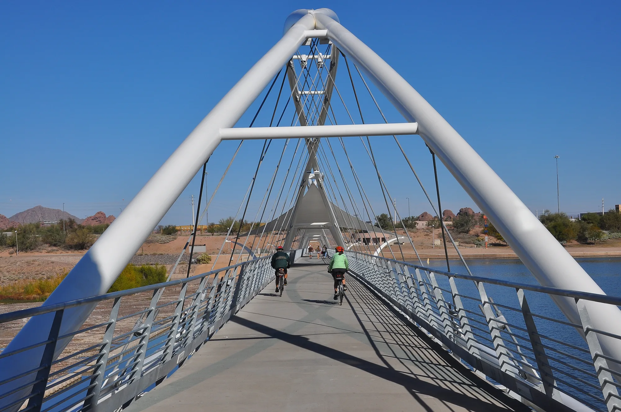
Tempe is a compact city, and the city says most residents live within half a mile of one of its more than fifty parks. What makes getting outside here different from its neighbors is water and stone: a lake built in a dry riverbed, two desert preserves rising out of the middle of town, and a web of canal paths that let you cross the city without sharing a road with cars. November through March is the season to use all of it.
Tempe Town Lake and Tempe Beach Park
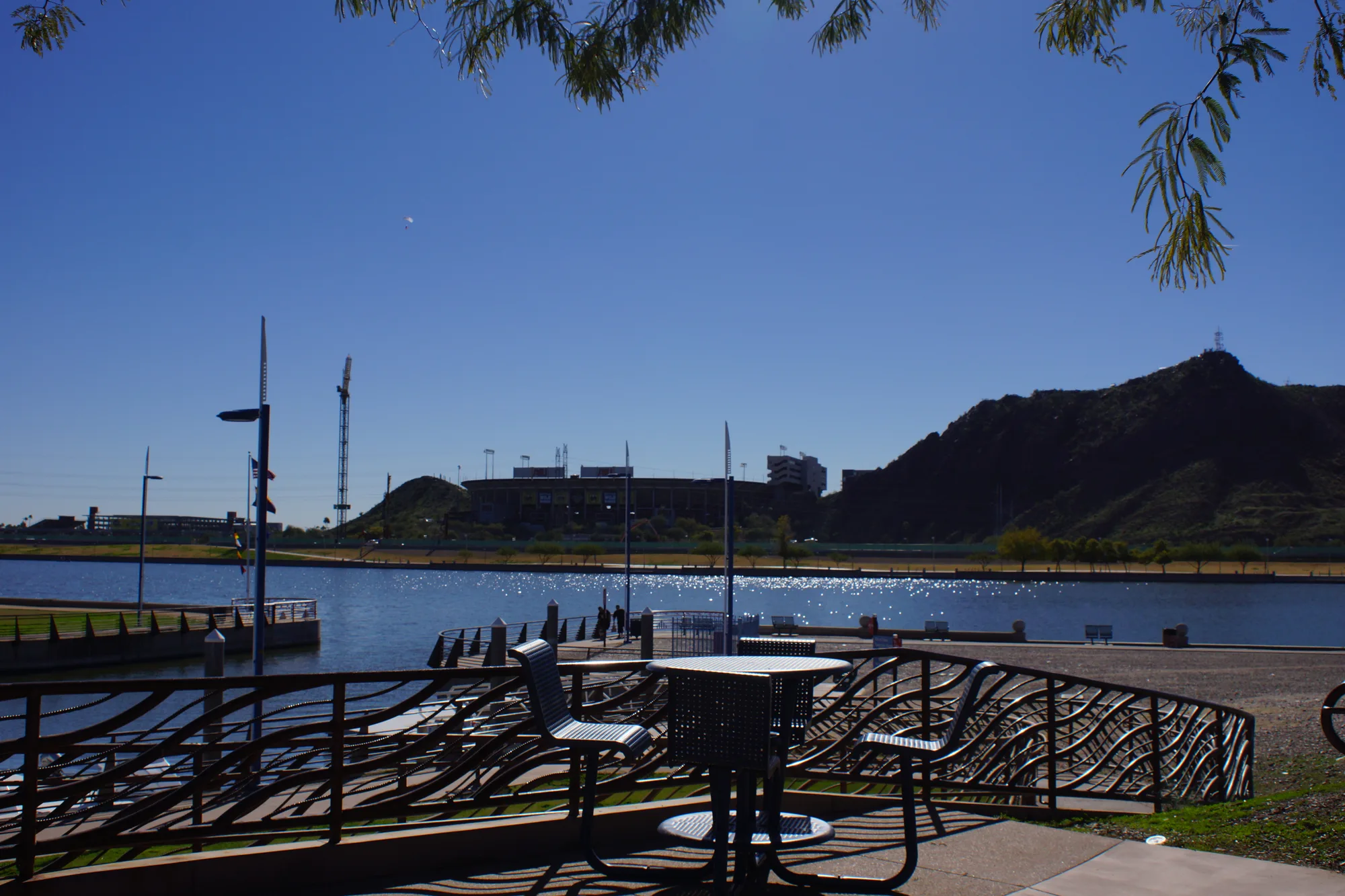
Tempe Town Lake stretches more than two miles between Rio Salado Parkway and Curry Road, from east of Priest Drive to west of McClintock Drive. It was created in 1999 by damming part of the dry Salt River, and it still does a river's job when it has to: the dam can be lowered to let floodwater pass. Seven and a half miles of continuous paths circle the lake for walking, running and cycling.
This month is a vivid reminder of that design. In early November, upstream reservoir releases sent water through the lake at up to 75,000 cubic feet per second, far more than the 2004 flood, and the city closed the lake to kayaking, paddleboarding, rowing and other boating until further notice. The parks around the lake stayed open, and fishing was still allowed. The city suggests the garage near Tempe Center for the Arts or Tempe Beach Park for a view of the dam at work.
Tempe Beach Park, at Mill Avenue and Rio Salado Parkway, is the lake's front lawn: 25 acres with paths, ramadas, picnic areas and a ballfield, and the stage for about forty events a year. It has been a gathering place since the 1920s, when it opened with Arizona's first Olympic-sized pool.
Two desert preserves in the middle of town
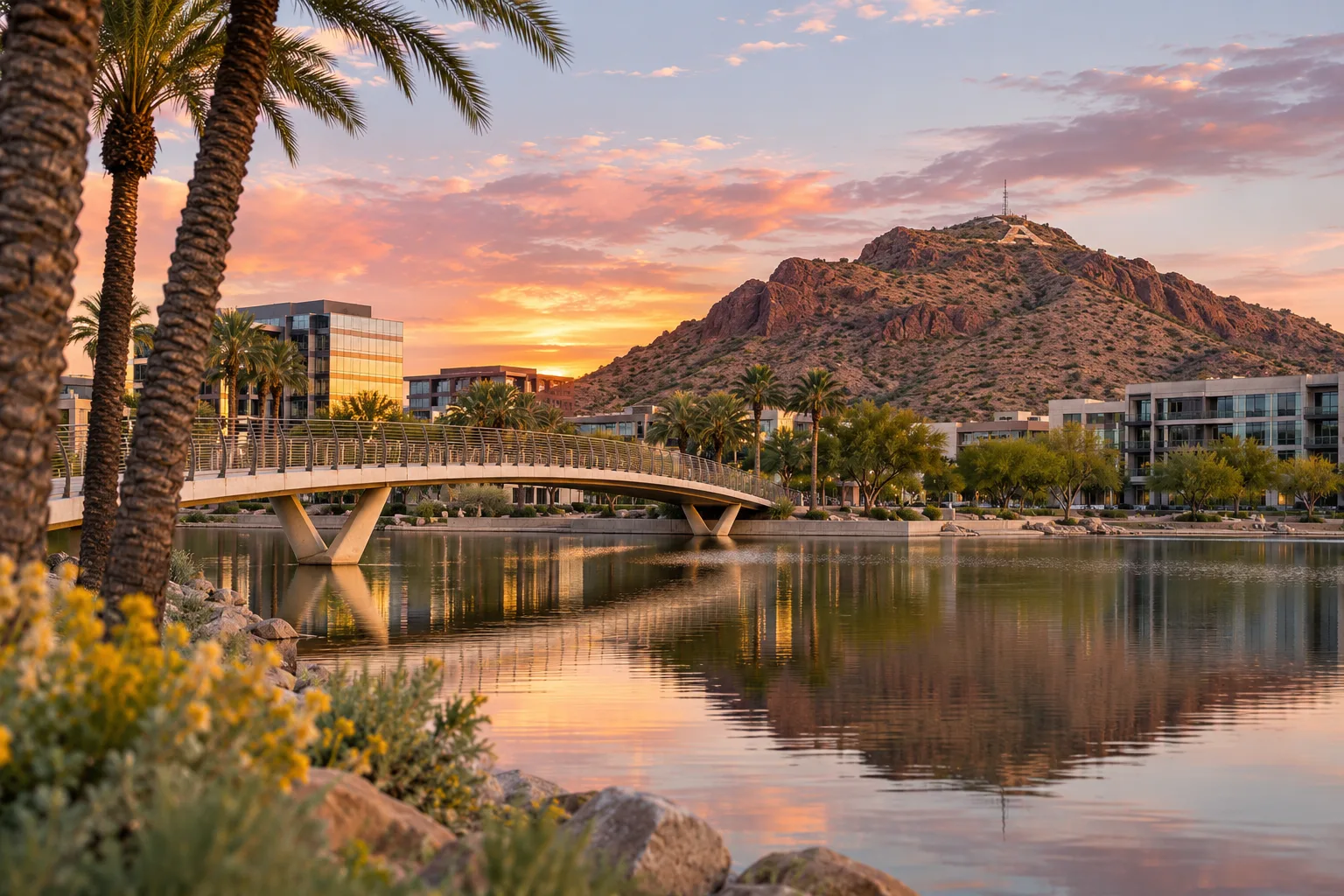
Hayden Butte, the hill most people call A Mountain, rises at Mill Avenue and Fifth Street right above downtown. The 25-acre preserve holds Sonoran desert plants, wildlife, rock outcrops and archaeological sites, and it became a city park in 1973 and a protected preserve in 2002. Its name honors Charles Trumbull Hayden, whose flour mill and ferry at the foot of the butte started the town. Because it is a preserve, hikers must stay on the designated trail, and bikes are not allowed on it.
At the north end of the city, Papago Preserve covers the desert between Mill Avenue, College Avenue, McKellips Road and the Loop 202, next to Tempe's Papago Park at 1000 N. College Ave., which has a fishing lake, playground, ramadas and a dog park. In the cooler months the city's park rangers lead free two-mile guided hikes through the preserve, explaining its plants, animals and geology; the next ones are on Sunday, November 15, and Sunday, December 13, and registration is required.
Both preserves are covered by a Preserves Management Plan the city council reviewed in April 2025, which sets out how the land should be protected and what kinds of recreation and education belong there.
Kiwanis Park and the neighborhood parks
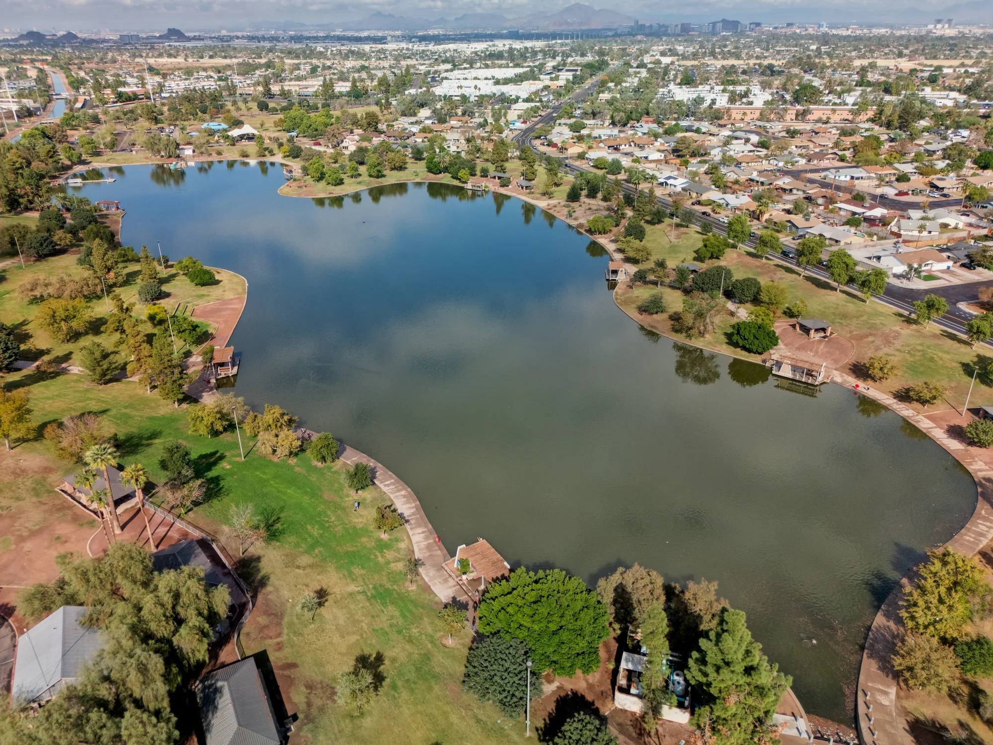
In South Tempe, 125-acre Kiwanis Park at Mill Avenue and All America Way is the city's big all-purpose park, bought in 1972 and named for the Kiwanis Club that funded its development. It has a lake for fishing, a splash playground, a dog park, playgrounds, ramadas, sports fields and courts, and the Kiwanis Recreation Center, home to one of the city's four public pools, an indoor wave pool.
Most Tempe parks open at 6 a.m. and close at 10 p.m. unless posted otherwise. Dogs are welcome on a leash, swimming and wading in park lakes is not allowed, and fishing and boating need permits.
Paths and canals for walking, running and cycling
Many of Tempe's multi-use paths follow the canals. The Crosscut Canal path runs 2.5 miles through north Tempe from Washington Street to the Scottsdale border, passing through Papago Park and linking Evelyn Hallman and Moeur parks. The Western Canal path crosses South Tempe for six miles from Arizona Mills to Price Road, and the Kyrene Canal path branches south from it toward Warner Road. The Highline Canal path, finished in 2020, covers 3.5 miles toward Chandler and the Town of Guadalupe.
Two projects will add to the network. Construction on Tempe's stretch of the Grand Canal path, north of the Loop 202 east of Priest Drive, is underway and scheduled to wrap up in early 2027. And in January 2025 the city won a $25 million federal grant to build a bicycle and pedestrian bridge across the east end of Town Lake, west of McClintock Drive, linking the north and south bank paths to the Indian Bend Wash path.
Before you head out
The city publishes a printable Tempe Bike Map, an interactive park map and a Town Lake map showing where to park, boat and ride, all on tempe.gov. Closures, like the lake's in November 2026, are posted in the city's news, and Tempe 311 can answer questions or reach a park ranger. Rangers can also explain the rules in the preserves, where the focus is on keeping a fragile landscape intact.
A few local stops pair well with an outing. Arizona Yoga Company, on Mill Avenue a short walk from the foot of Hayden Butte, teaches donation-based classes every day of the year, and every class on its weekly schedule is pay what you can. Cartel Roasting Co.'s Maple Ash café on South Ash Avenue opens early every day, which suits a sunrise loop around the lake. And in The Lakes neighborhood of South Tempe, family-owned Pier 54 is an outdoor-only restaurant on the lakeshore with weekend brunch, a relaxed end to a morning on the canal paths.
Sources and further reading 20
- City of Tempe: tempe.gov/government/community-services/parkschecked November 7, 2026 · More than 50 parks; most residents within half a mile; park hours 6 a.m.-10 p.m. unless posted; leashed pets; swimming/wading prohibited; permits for boating and fishing.
- City of Tempe: tempe.gov/recreation/tempe-town-lakechecked November 7, 2026 · Town Lake more than 2 miles long, created by damming the dry Salt River, origin 1999; acts like a river when the dam is lowered; location between Rio Salado Pkwy and Curry Rd, west of McClintock to east of Priest; paths; lake map.
- City of Tempe: tempe.gov/government/transportation-and-sustainability/transportation/bicycle-pedestrian/multi-use-paths-and-bridges-completedchecked November 7, 2026 · Rio Salado paths: 7.5 miles of continuous paths around the lake; Crosscut Canal path 2.5 miles Washington St to Scottsdale border through Papago Park linking Evelyn Hallman and Moeur parks; Western Canal 6 miles Arizona Mills to Price Rd; Kyrene Canal path to south of Warner; Highline Canal 3.5 miles, completed 2020, to Chandler and Guadalupe.
- City of Tempe (Tempe This Week newsletter): tempe.gov/Home/Components/News/News/19083/1546Published November 2, 2026 · checked November 7, 2026 · Town Lake closed for boating; flows up to 75,000 cfs vs 44,000 in 2004; land activities continue; view the dam from the garage near Tempe Center for the Arts or Tempe Beach Park.
- City of Tempe: tempe.gov/Home/Components/News/News/19081/1546checked November 7, 2026 · All on-water recreation paused (paddle boating, kayaking, SUP, rowing, sailing); parks around the lake open; fishing allowed; Tempe 311 for questions.
- City of Tempe: tempe.gov/Home/Components/FacilityDirectory/FacilityDirectory/176/3542checked November 7, 2026 · Tempe Beach Park: 25 acres, paths, picnic areas, ramadas, ballfield, about 40 events a year, gathering place since the early 1920s, Arizona's first Olympic-sized pool built 1923.
- City of Tempe: tempe.gov/Home/Components/FacilityDirectory/FacilityDirectory/100/3542checked November 7, 2026 · Hayden Butte Preserve at Mill Ave and 5th St: 25 acres; park 1973; preserve 2002; vegetation, wildlife, rock outcrops, archaeological sites; named for Charles Trumbull Hayden (mill, ferry); designated trails only, no bikes.
- City of Tempe: tempe.gov/Home/Components/FacilityDirectory/FacilityDirectory/690/3542checked November 7, 2026 · Papago Preserve boundaries: Mill Ave, College Ave, McKellips Rd and the 202.
- City of Tempe: tempe.gov/Home/Components/FacilityDirectory/FacilityDirectory/146/3542checked November 7, 2026 · Papago Park, 1000 N College Ave: fishing lake, playground, ramadas, dog park.
- City of Tempe: tempe.gov/government/community-services/parks/park-rangerschecked November 7, 2026 · Ranger guided hikes in cooler months through Papago Preserve, moderate two-mile hike, free registration, next on Nov 15 and Dec 13; rangers reached through Tempe 311; education first.
- City of Tempe: tempe.gov/government/community-services/parks/preserves-management-planchecked November 7, 2026 · Preserves Management Plan for Papago and Hayden Butte; final draft presented to council April 24, 2025; protection and recreation/education recommendations.
- City of Tempe: tempe.gov/Home/Components/FacilityDirectory/FacilityDirectory/120/3542checked November 7, 2026 · Kiwanis Park: Mill Ave and All America Way; 125 acres; land bought 1972; named for Kiwanis Club; lake, fishing, splash playground, dog park, playground, ramadas, fields, courts, recreation center.
- City of Tempe: tempe.gov/government/community-services/community-recreation-centers/kiwanis-recreation-center/aquaticschecked November 7, 2026 · Four public pools including the indoor wave pool at Kiwanis Recreation Center.
- City of Tempe: tempe.gov/government/transportation-and-sustainability/transportation/bicycle-pedestrian/grand-canalchecked November 7, 2026 · Grand Canal path north of the 202 east of Priest Drive; construction underway, set to wrap up early 2027.
- City of Tempe: tempe.gov/government/transportation-and-sustainability/transportation/bicycle-pedestrian/upstream-dam-bike-ped-bridgechecked November 7, 2026 · Upstream bridge west of McClintock connecting north and south banks; $25 million federal RAISE grant January 2025; links to Indian Bend Wash path.
- City of Tempe: tempe.gov/recreation/bikingchecked November 7, 2026 · Tempe Bike Map PDF and BIKEiT route map.
- City of Tempe: tempe.gov/government/community-services/parks/city-park-mapchecked November 7, 2026 · Interactive park map.
- Arizona Yoga Company: arizonayogaco.comchecked November 7, 2026 · Donation-based yoga; all weekly classes pay what you can; live studio classes 365 days a year.
- Cartel Roasting Co.: cartelroasting.co/pages/locationschecked November 7, 2026 · Tempe Maple Ash, 810 S Ash Ave, open daily from 6 AM.
- Pier 54: pier54az.comchecked November 7, 2026 · Family owned; outdoor-only restaurant on the lakeshore in The Lakes neighborhood of Tempe; weekend brunch.